Business Details
12 Years
experience
Trusted Real Estate Photography Services in York, PA
Founded in 2014, our company has built a reputation for delivering high-quality real estate photography services across South-Central Pennsylvania and Northern Maryland. We combine technical expertise with creative vision to produce images that highlight properties' unique features while meeting the practical needs of real estate agents. Our team of certified FAA-licensed drone operators brings over a decade of combined experience in real estate photography, aerial imaging, and virtual tour creation. We maintain rigorous quality control through in-house editing processes and guarantee next-day delivery of professionally edited photographs.Our commitment to innovation is demonstrated through specialized services like 3D parcel line mapping, virtual staging, and twilight conversion photography. We prioritize client relationships by offering personalized consultations and transparent pricing structures. Our investment in cutting-edge equipment ensures clients receive 4K aerial video, 20-megapixel imagery, and interactive floor plans compatible with major real estate platforms. We adhere to strict professional standards while maintaining cost-effective solutions for our clients.
Services
Real Estate Photography
Aerial Drone Services
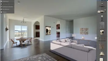
Virtual Tours
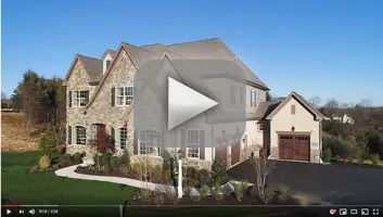
Walkthrough Videos
Parcel Line Mapping
Virtual Staging
Luxury Home Photography
360 Floor Plans
Twilight Conversion
Property Line Tool
Details
- Year established: 2014
Highlights and features
- 10 years of specialized real estate photography experience
- FAA-certified drone operators with advanced imaging equipment
- Free twilight conversion with every photo shoot package
- In-house editing team ensures consistent quality control
- Serving 6+ counties with flexible scheduling options
Associations and certifications
- FAA Licensed
What people say
Exceptional quality photos
Fast turnaround time
Professional drone operation
Helpful virtual tools
Knowledgeable staff
Services
Real Estate Photography
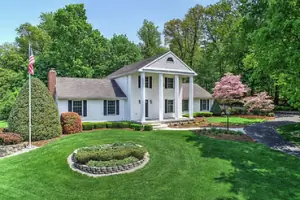
Professional MLS-compliant photography packages capture properties' best features using HDR technology and expert composition. Our photographers dedicate time to optimize lighting conditions and architectural details. Packages include up to 40 edited images with optional twilight conversion and virtual staging enhancements.
Aerial Drone Services
FAA-certified drone operations provide 4K aerial video and 20-megapixel stills for property marketing. We create 2D maps and 3D renders suitable for commercial real estate and construction sites. Services include property boundary visualization and large-acreage imaging unavailable through standard drone limitations.
Virtual Tours
Interactive virtual tours compatible with all devices feature high-resolution imagery and VR capabilities. Packages include free hosting and support for major platforms like Zillow Showcase. Custom tours help properties stand out with immersive walkthrough experiences accessible from any digital device.
Parcel Line Mapping
GPS-accurate parcel line visualization combines satellite imagery with tax record data to show property boundaries and terrain contours. Services provide 10 multi-angle views with elevation details for marketing purposes. Available nationwide with optional client-provided plat map integration.
Walkthrough Videos
Two-minute walkthrough videos complement photo packages with simple, music-free presentations ideal for Zillow listings and social media. Videos highlight spatial relationships and property flow while maintaining professional quality standards for real estate marketing purposes.
People
John Beatty
Co-Owner
Co-founder with 10 years of real estate photography experience. Specializes in luxury property imaging and aerial boundary visualization. Manages technical operations and quality control processes.
Jen Beatty
Co-Owner
Co-founder responsible for client relations and service coordination. Brings expertise in real estate marketing needs and digital asset management solutions for agents.
Mike Woltman
Lead Photographer
Certified FAA drone operator with specialized skills in twilight photography and virtual staging. Provides on-site imaging services across multiple Pennsylvania counties.
Questions
What areas do you service?
We cover South-Central Pennsylvania including York, Adams, Cumberland, Perry, Dauphin, and Lebanon counties, plus Northern Maryland.
Do you offer rush services?
Yes, we provide rush processing for an additional $45 fee with guaranteed same-day delivery.
Are travel fees applied?
Travel fees may apply for locations beyond our standard service areas. Contact us for specific quotes.
What's included in standard packages?
All packages include up to 40 HDR photos, full feature floor plans, and next-day delivery with free twilight conversion.
Can I book online?
Yes, online scheduling is available though we recommend direct contact for optimal appointment coordination.
What payment methods are accepted?
We accept major credit cards and electronic transfers. Payment terms are confirmed during booking.